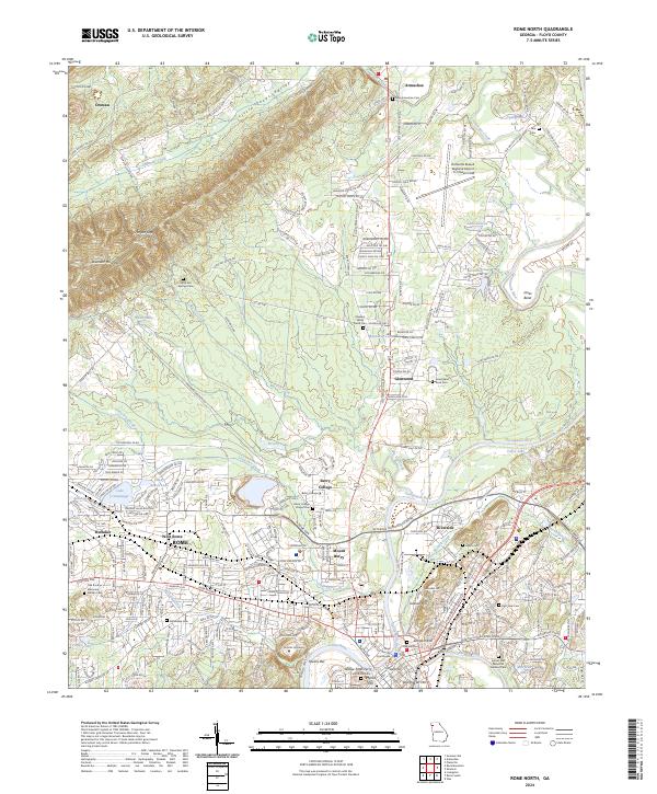
2024 Map of Rome North
USGS Topo · Published 2024About this map
Berry College and the extensive grounds of Shorter University dominate the northern and western landscapes of this region where the Oostanaula River and Etowah River converge to form the Coosa River. The map details the transition from the city center of Rome, marked by the Floyd County Courthouse, to the more rural stretches of Little Texas Valley and the slopes of Lavender Mountain. A notable concentration of historic sites is found at the river confluence, including Myrtle Hill and the location of the Widow Fools Ferry. The presence of the Richard B Russell Regional Airport and the Norfolk Southern rail line highlights the area's role as a transportation hub, while numerous local landmarks like Mount Berry and Glenwood illustrate the historic growth of these north Georgia communities.
Find a feature on this map
287 named features on this map. Tap any name to fly to it.
Don’t see what you’re looking for? This feature index may not catch every label — zoom into the map to look around manually.
Map Details
Editions of this 2024 Rome North Map
This is the sole edition of this map. No revisions or reprints were ever made.
Other maps of this area

1886 · Rome
USGS Topo · 1:125,000

1898 · Rome
USGS Topo · 1:125,000

1899 · Rome
USGS Topo · 1:125,000

1904 · Rome
USGS Topo · 1:125,000

1955 · Rome
USGS Topo · 1:250,000

1958 · Rome
USGS Topo · 1:250,000

1961 · Rome
USGS Topo · 1:250,000

1963 · Rome
USGS Topo · 1:250,000
1967 · Summerville
USGS Topo · 1:24,000
1967 · Rock Mountain
USGS Topo · 1:24,000