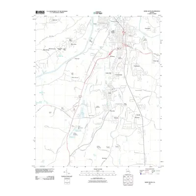
2011 Map of Rome South
USGS Topo · Published 2011About this map
The Coosa River and Etowah River converge just north of this area, defining a landscape where industrial heritage meets residential growth south of Rome. The community of Lindale serves as a central hub, historically tied to the textile industry, and is documented here alongside its Lindale Post Office and nearby Gaither Park. The terrain is marked by significant ridges such as Walker Mountain and Saddle Mountain, which separate the river valleys from developing suburbs like Chulio Hills and Twickenham.
Find a feature on this map
100 named features on this map. Tap any name to fly to it.
Don’t see what you’re looking for? This feature index may not catch every label — zoom into the map to look around manually.
Map Details
Editions of this 2011 Rome South Map
This is the sole edition of this map. No revisions or reprints were ever made.
Other maps of this area

1886 · Rome
USGS Topo · 1:125,000

1898 · Rome
USGS Topo · 1:125,000

1899 · Rome
USGS Topo · 1:125,000

1904 · Rome
USGS Topo · 1:125,000

1955 · Rome
USGS Topo · 1:250,000

1958 · Rome
USGS Topo · 1:250,000

1961 · Rome
USGS Topo · 1:250,000

1963 · Rome
USGS Topo · 1:250,000
1967 · Rock Mountain
USGS Topo · 1:24,000
1967 · Cedartown West
USGS Topo · 1:24,000