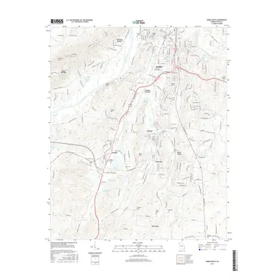
2017 Map of Rome South
USGS Topo · Published 2017About this map
The confluence of the Etowah River and Coosa River anchors this study of the landscape south of Rome, Georgia. The terrain transitions from the high peaks of Horseleg Mtn and Mt Alto in the west to the industrial and educational corridors stretching toward Lindale and Silver Creek. Regional growth is evident along the Southern Railway lines at Atlanta Junction, while the presence of Georgia Highlands Coll and Coosa Valley Technical Coll marks the area's development as a modern academic hub.
Find a feature on this map
218 named features on this map. Tap any name to fly to it.
Don’t see what you’re looking for? This feature index may not catch every label — zoom into the map to look around manually.
Map Details
Editions of this 2017 Rome South Map
This is the sole edition of this map. No revisions or reprints were ever made.
Other maps of this area

1886 · Rome
USGS Topo · 1:125,000

1898 · Rome
USGS Topo · 1:125,000

1899 · Rome
USGS Topo · 1:125,000

1904 · Rome
USGS Topo · 1:125,000

1955 · Rome
USGS Topo · 1:250,000

1958 · Rome
USGS Topo · 1:250,000

1961 · Rome
USGS Topo · 1:250,000

1963 · Rome
USGS Topo · 1:250,000
1967 · Rock Mountain
USGS Topo · 1:24,000
1967 · Cedartown West
USGS Topo · 1:24,000