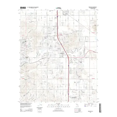
2015 Map of Romoland
USGS Topo · Published 2015About this map
The San Jacinto River meanders across the northern reaches of this Riverside County landscape, where the communities of Romoland and Sun City anchor a rapidly expanding suburban network. This 2015 study illustrates the dense residential developments of Menifee and Menifee Lakes, contrasted against the high terrain of Double Butte and Bell Mtn. The map reveals the intricate infrastructure of the southern Inland Empire, dominated by major thoroughfares like McCall Blvd and Domenigoni Pky. Significant natural features such as Cottonwood Canyon and the Warm Springs Cr define the south, while Canyon Lake and Quail Valley sit at the western edge. These labels reflect the transition from the broad Perris Valley into the Paloma Valley, showing how contemporary residential footprints have filled the spaces between historic peaks and seasonal creek beds.
Find a feature on this map
29 named features on this map. Tap any name to fly to it.
Don’t see what you’re looking for? This feature index may not catch every label — zoom into the map to look around manually.
Map Details
Editions of this 2015 Romoland Map
This is the sole edition of this map. No revisions or reprints were ever made.
Other maps of this area

1901 · Southern California Sheet No. 1
USGS Topo · 1:250,000

1901 · Elsinore
USGS Topo · 1:125,000

1901 · Riverside
USGS Topo · 1:62,500

1904 · Southern California Sheet No. 1
USGS Topo · 1:250,000

1942 · Lake Elsinore
USGS Topo · 1:62,500

1942 · Murrieta
USGS Topo · 1:62,500

1942 · Riverside
USGS Topo · 1:62,500

1942 · Perris
USGS Topo · 1:62,500

1943 · Perris
USGS Topo · 1:62,500

1943 · Riverside
USGS Topo · 1:62,500