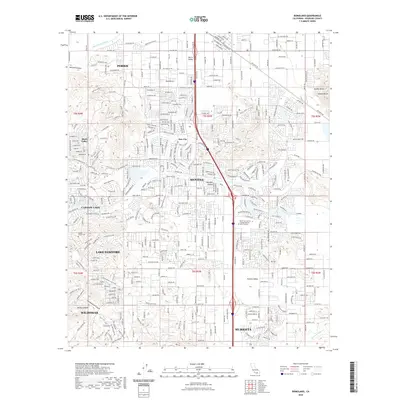
2022 Map of Romoland
USGS Topo · Published 2022About this map
Perris Valley and the surrounding basin of Riverside County are detailed here in a period of significant suburban expansion and connectivity. The landscape is defined by its broad valleys, including Menifee Valley and Paloma Valley, which are divided by prominent terrain like Double Butte and the winding course of the San Jacinto River. The infrastructure shown reflects a modern residential and educational network, notably featuring the Mount San Jacinto College Menifee Valley Campus.
Find a feature on this map
26 named features on this map. Tap any name to fly to it.
Don’t see what you’re looking for? This feature index may not catch every label — zoom into the map to look around manually.
Map Details
Editions of this 2022 Romoland Map
This is the sole edition of this map. No revisions or reprints were ever made.
Other maps of this area

1901 · Southern California Sheet No. 1
USGS Topo · 1:250,000

1901 · Elsinore
USGS Topo · 1:125,000

1901 · Riverside
USGS Topo · 1:62,500

1904 · Southern California Sheet No. 1
USGS Topo · 1:250,000

1942 · Lake Elsinore
USGS Topo · 1:62,500

1942 · Murrieta
USGS Topo · 1:62,500

1942 · Riverside
USGS Topo · 1:62,500

1942 · Perris
USGS Topo · 1:62,500

1943 · Perris
USGS Topo · 1:62,500

1943 · Riverside
USGS Topo · 1:62,500