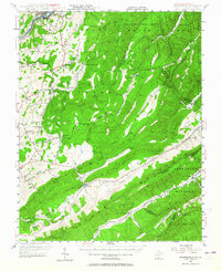
1948 Map of Ronceverte
USGS Topo · Published 1964About this map
Ronceverte and the northern reaches of the Jefferson National Forest anchor this mid-century survey of the West Virginia and Virginia borderlands. The landscape is defined by the parallel ridges of White Rock Mountain and Peters Mountain, creating narrow valleys where small agrarian settlements like Gap Mills, Monitor, and Keenan were established. Local industry and travel are reflected in the Chesapeake and Ohio railroad corridor along the Greenbrier River and the presence of numerous neighborhood institutions, including the Highland Green Sch and Antioch Ch.
Find a feature on this map
82 named features on this map. Tap any name to fly to it.
Don’t see what you’re looking for? This feature index may not catch every label — zoom into the map to look around manually.
Map Details
Editions of this 1948 Ronceverte Map
This is the sole edition of this map. No revisions or reprints were ever made.
Other maps of this area

1887 · Hinton
USGS Topo · 1:125,000

1887 · Lewisburg
USGS Topo · 1:125,000

1890 · Dublin
USGS Topo · 1:125,000

1890 · Christiansburg
USGS Topo · 1:125,000

1891 · Lewisburg
USGS Topo · 1:125,000

1891 · Dublin
USGS Topo · 1:125,000

1892 · Hinton
USGS Topo · 1:125,000

1921 · Callaghan
USGS Topo · 1:48,000

1921 · Alderson
USGS Topo · 1:48,000

1921 · White Sulphur Springs
USGS Topo · 1:48,000