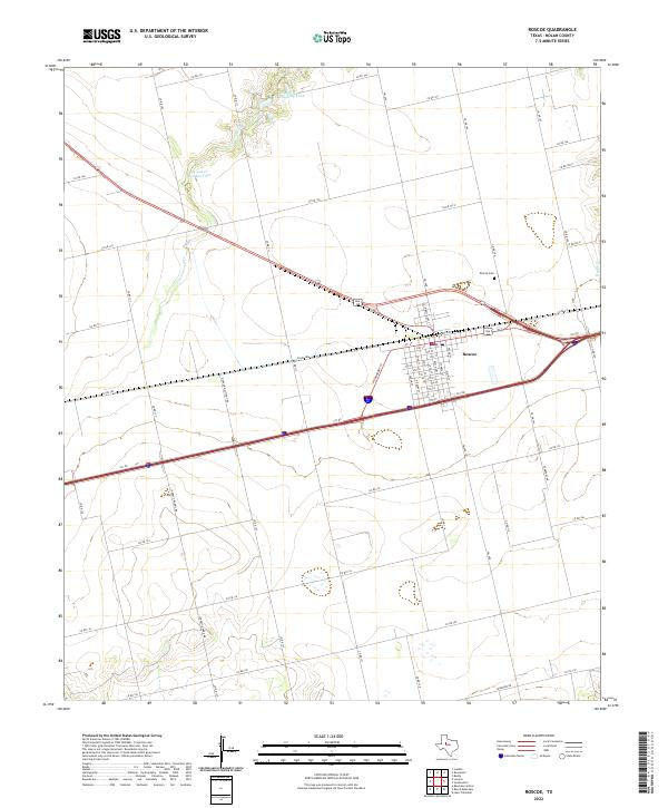
2022 Map of Roscoe
USGS Topo · Published 2022About this map
Roscoe serves as the focal point of this West Texas landscape, where the town's grid is defined by a series of numbered thoroughfares from 1st St down to 9th St. The intersection of modern transportation routes and older rural infrastructure is evident in the transition from the town center to the expansive ranch and agricultural lands of Nolan County. Water management is a critical feature of the terrain, marked by the Cottonwood Cr drainage and specific industrial water features like the H and H Feedlot Tank and H and H Conditioning Tank. For those researching local heritage, the Roscoe Cem stands just northeast of the main settlement. The surrounding area is crisscrossed by an extensive network of county roads, such as Co Rd 152 and Champion Rd, illustrating the persistence of established land divisions in the modern era.
Find a feature on this map
48 named features on this map. Tap any name to fly to it.
Don’t see what you’re looking for? This feature index may not catch every label — zoom into the map to look around manually.
Map Details
Editions of this 2022 Roscoe Map
This is the sole edition of this map. No revisions or reprints were ever made.
Other maps of this area

1893 · Roby
USGS Topo · 1:125,000

1893 · Sweetwater
USGS Topo · 1:125,000

1954 · Big Spring
USGS Topo · 1:250,000

1958 · Big Spring
USGS Topo · 1:250,000

1969 · Baumann School
USGS Topo · 1:24,000

1969 · Busby
USGS Topo · 1:24,000

1969 · Bench Mountain
USGS Topo · 1:24,000

1969 · Loraine
USGS Topo · 1:24,000

1969 · Bernecker
USGS Topo · 1:24,000

1969 · Roscoe
USGS Topo · 1:24,000