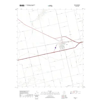
2019 Map of Roscoe
USGS Topo · Published 2019About this map
Roscoe serves as the central hub of this Nolan County landscape, where a grid of residential streets including W Broadway St and N Bois D Arc St meets the major transportation corridors of the region. The town is situated amidst a vast network of rural routes such as Duncan Hastings Rd and Co Rd 182, reflecting the agricultural and ranching infrastructure of West Texas. To the north, the Roscoe Cem provides a focal point for genealogical research, while the surrounding plains are marked by water features like Cottonwood Cr and Rough Cr. The landscape also highlights specialized industrial sites like the H and H Feedlot Tank and H and H Conditioning Tank, illustrating the local livestock economy. This 2019 survey documents the intersection of modern interstate travel and traditional rural development in a key community of the Llano Estacado region.
Find a feature on this map
61 named features on this map. Tap any name to fly to it.
Don’t see what you’re looking for? This feature index may not catch every label — zoom into the map to look around manually.
Map Details
Editions of this 2019 Roscoe Map
This is the sole edition of this map. No revisions or reprints were ever made.
Other maps of this area

1893 · Roby
USGS Topo · 1:125,000

1893 · Sweetwater
USGS Topo · 1:125,000

1954 · Big Spring
USGS Topo · 1:250,000

1958 · Big Spring
USGS Topo · 1:250,000

1969 · Baumann School
USGS Topo · 1:24,000

1969 · Busby
USGS Topo · 1:24,000

1969 · Bench Mountain
USGS Topo · 1:24,000

1969 · Loraine
USGS Topo · 1:24,000

1969 · Bernecker
USGS Topo · 1:24,000

1969 · Roscoe
USGS Topo · 1:24,000