
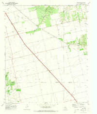
1969 Map of Loraine
USGS Topo · Published 1972About this map
The town of Loraine serves as the focal point of this late-1960s landscape, positioned where the Texas and Pacific railroad bisects the West Texas terrain. The map captures a moment when the regional economy was defined by a network of ranching roads, pipelines, and extraction sites like the numerous Gravel Pits scattered near Wastella. To the north, Lone Wolf Mountain provides a prominent natural landmark, while the drainage of the North Fork Champion Creek carves a path toward the local Sewage Disposal Pond. Local history and genealogy are well-represented by several rural burial sites, including Union Chapel Cem and Wallace Cem, alongside the Union Chapel church. Notable mid-century cultural markers are also preserved here, such as a Drive-in Theater on the western edge of the Loraine townsite and a Roadside Park along the primary highway.
Find a feature on this map
27 named features on this map. Tap any name to fly to it.
Don’t see what you’re looking for? This feature index may not catch every label — zoom into the map to look around manually.
Map Details
Editions of this 1969 Loraine Map
This is the sole edition of this map. No revisions or reprints were ever made.
Other maps of this area

1950 · Colorado City SE
USGS Topo · 1:24,000

1952 · China Grove
USGS Topo · 1:24,000

1952 · Colorado City
USGS Topo · 1:24,000

1954 · Big Spring
USGS Topo · 1:250,000

1958 · Big Spring
USGS Topo · 1:250,000

1969 · Baumann School
USGS Topo · 1:24,000

1969 · Bench Mountain
USGS Topo · 1:24,000

1969 · Bernecker
USGS Topo · 1:24,000

1969 · Roscoe
USGS Topo · 1:24,000
1969 · Inadale
USGS Topo · 1:24,000