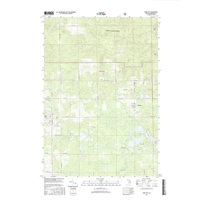
2017 Map of Rose City
USGS Topo · Published 2017About this map
Rose City and the nearby settlement of Lupton anchor this northern Michigan landscape, where the headwaters of numerous creeks begin their descent through the Huron National Forest. The area is defined by a dense concentration of glacial lakes and ponds, including Grousehaven Lake, Devoe Lake, and the uniquely named Devils Washbasin. These water bodies are connected by a network of drainage systems like Houghton Creek and Oyster Creek, which weave through the forested terrain and cedar swamps.
Find a feature on this map
92 named features on this map. Tap any name to fly to it.
Don’t see what you’re looking for? This feature index may not catch every label — zoom into the map to look around manually.
Map Details
Editions of this 2017 Rose City Map
This is the sole edition of this map. No revisions or reprints were ever made.
Other maps of this area

1954 · Traverse City
USGS Topo · 1:250,000

1954 · Tawas City
USGS Topo · 1:250,000

1958 · Traverse City
USGS Topo · 1:250,000

1958 · Tawas City
USGS Topo · 1:250,000

1965 · Damon
USGS Topo · 1:24,000

1965 · West Branch
USGS Topo · 1:24,000

1965 · Selkirk
USGS Topo · 1:24,000

1965 · Rose City
USGS Topo · 1:24,000

1968 · Sage Lake
USGS Topo · 1:24,000

1968 · South Branch
USGS Topo · 1:24,000