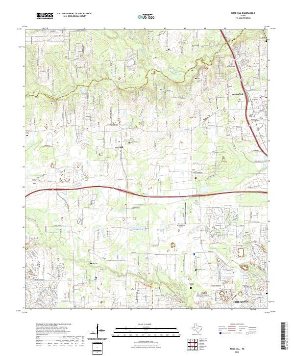
2022 Map of Rose Hill
USGS Topo · Published 2022About this map
Tomball and Rose Hill anchor this corner of the Texas landscape, where suburban expansion meets legacy homesteads. The terrain is defined by a series of prominent waterways, including Spring Cr, Willow Cr, and Little Cypress Cr, which drain the low-lying Willow Flats and Faulkey Gully. This survey reveals a high density of family burial grounds and community institutions, suggesting deep genealogical roots amidst the modern growth. Researchers will find numerous sites of local historical value, from the Salem Lutheran Cem near the northern border to the Saint John Cem further south. The map also highlights significant educational and aviation infrastructure, such as the Lone Star College - Tomball Campus and the Dan Jones International Airport, illustrating the area's role as a regional hub north of Houston.
Find a feature on this map
230 named features on this map. Tap any name to fly to it.
Don’t see what you’re looking for? This feature index may not catch every label — zoom into the map to look around manually.
Map Details
Editions of this 2022 Rose Hill Map
This is the sole edition of this map. No revisions or reprints were ever made.
Other maps of this area

1915 · Cypress
USGS Topo · 1:24,000

1916 · Rose Hill
USGS Topo · 1:24,000

1916 · Louetta
USGS Topo · 1:24,000

1916 · Hockley
USGS Topo · 1:24,000

1916 · Satsuma
USGS Topo · 1:24,000

1916 · Swanson
USGS Topo · 1:24,000

1918 · Cypress
USGS Topo · 1:31,680

1919 · Swanson
USGS Topo · 1:31,680

1920 · Hockley
USGS Topo · 1:31,680

1920 · Rose Hill
USGS Topo · 1:31,680