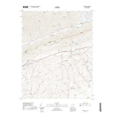
2019 Map of Rose Hill
USGS Topo · Published 2019About this map
Cumberland Mountain forms a towering natural spine across this borderland, where the Kentucky Virginia state line follows the high ridges of the Tennessee Valley Divide. Below the heights, the landscape is defined by the parallel orientation of Poor Valley and Long Hollow, terrain that dictated the historic routes of the Daniel Boone Trl and Wilderness Rd. Small family and community histories are preserved in the numerous burial sites scattered across the valley floor, including the Shackelford Cem near Rose Hill and the Crockett Cem farther east.
Find a feature on this map
132 named features on this map. Tap any name to fly to it.
Don’t see what you’re looking for? This feature index may not catch every label — zoom into the map to look around manually.
Map Details
Editions of this 2019 Rose Hill Map
This is the sole edition of this map. No revisions or reprints were ever made.
Other maps of this area

1887 · Jonesville
USGS Topo · 1:125,000

1891 · Jonesville
USGS Topo · 1:125,000

1903 · Harlan
USGS Topo · 1:48,000

1916 · Harlan
USGS Topo · 1:48,000

1916 · Nolansburg
USGS Topo · 1:48,000

1919 · Nolansburg
USGS Topo · 1:62,500

1919 · Harlan
USGS Topo · 1:62,500

1932 · Hagan
USGS Topo · 1:62,500
1935 · Ewing
USGS Topo · 1:24,000

1935 · Hubbard Springs
USGS Topo · 1:24,000