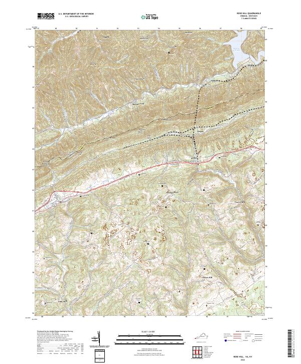
2022 Map of Rose Hill
USGS Topo · Published 2022About this map
Cumberland Mountain dominates the landscape of this southwestern Virginia borderland, where the Kentucky-Virginia state line follows the high ridges of Little Black Mtn. The rugged geography of Lee County is defined by the steep descent from Timber Ridge into the Poor Valley, a narrow corridor where early migration routes like the Daniel Boone Trl and Wilderness Rd carved paths through the terrain. Small settlements such as Henegartown and Wilson Hill are scattered among the hollows, often centered near local landmarks like Carrol Mill or Edds Mill. Numerous family-named burial grounds, including Shackelford Cem, Crockett Cem, and Bales Cem, provide a direct connection to the region's deep ancestral roots. The northern portion of the map is shaped by the waters of the Martins Fork Cumberland River and the recreation area surrounding Martins Fork Lake.
Find a feature on this map
127 named features on this map. Tap any name to fly to it.
Don’t see what you’re looking for? This feature index may not catch every label — zoom into the map to look around manually.
Map Details
Editions of this 2022 Rose Hill Map
This is the sole edition of this map. No revisions or reprints were ever made.
Other maps of this area

1887 · Jonesville
USGS Topo · 1:125,000

1891 · Jonesville
USGS Topo · 1:125,000

1903 · Harlan
USGS Topo · 1:48,000

1916 · Harlan
USGS Topo · 1:48,000

1916 · Nolansburg
USGS Topo · 1:48,000

1919 · Nolansburg
USGS Topo · 1:62,500

1919 · Harlan
USGS Topo · 1:62,500

1932 · Hagan
USGS Topo · 1:62,500
1935 · Ewing
USGS Topo · 1:24,000

1935 · Hubbard Springs
USGS Topo · 1:24,000