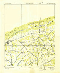
1935 Map of Rose Hill
USGS Topo · Published 1935About this map
The Old Wilderness Trail cuts through the center of this landscape, tracing a historic path of migration just south of Cumberland Mountain. By the mid-1930s, the rural character of Lee County was defined by a dense network of family-named schools and churches, such as Enon Ch and Brooks Hall Sch, which served as the social anchors for scattered communities like Rose Hill and Hagan. The presence of the CCC Camp TVA No 5 reflects the era's federal investment in the region under the Tennessee Valley Authority.
Find a feature on this map
52 named features on this map. Tap any name to fly to it.
Don’t see what you’re looking for? This feature index may not catch every label — zoom into the map to look around manually.
Map Details
Editions of this 1935 Rose Hill Map
This is the sole edition of this map. No revisions or reprints were ever made.
Other maps of this area

1887 · Jonesville
USGS Topo · 1:125,000

1891 · Jonesville
USGS Topo · 1:125,000

1903 · Harlan
USGS Topo · 1:48,000

1916 · Harlan
USGS Topo · 1:48,000

1916 · Nolansburg
USGS Topo · 1:48,000

1919 · Nolansburg
USGS Topo · 1:62,500

1919 · Harlan
USGS Topo · 1:62,500

1932 · Hagan
USGS Topo · 1:62,500
1935 · Ewing
USGS Topo · 1:24,000

1935 · Hubbard Springs
USGS Topo · 1:24,000