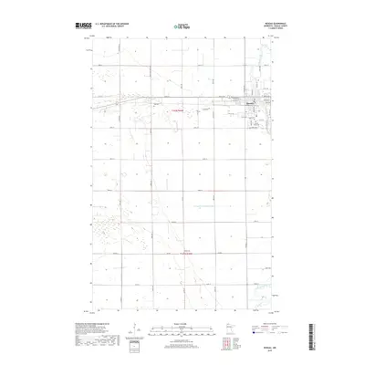
2019 Map of Roseau
USGS Topo · Published 2019About this map
Roseau sits as the primary hub in this northern Minnesota landscape, where the Roseau River and the S Fork Roseau River converge. The town's grid is well-established, featuring landmarks such as Hope Cem, Sacred Heart Cem, and several local streets like Oak Crest Blvd and Main Ave N. Outside the immediate settlement, the terrain is defined by a systematic grid of section roads, including 310th St and 320th St, which facilitate access across the agricultural and wetland-heavy flats. This 2019 data highlights a landscape heavily modified for water management, most notably by the County Ditch Number Eight and other drainage features. Remote family and community burial grounds, such as Rose Cem and Bethel Cem, are scattered through the township, providing essential points of interest for genealogists tracing regional heritage in Roseau County.
Find a feature on this map
47 named features on this map. Tap any name to fly to it.
Don’t see what you’re looking for? This feature index may not catch every label — zoom into the map to look around manually.
Map Details
Editions of this 2019 Roseau Map
This is the sole edition of this map. No revisions or reprints were ever made.
Other maps of this area

1918 · Goos
USGS Topo · 1:62,500

1918 · Pencer
USGS Topo · 1:62,500

1918 · Roseau
USGS Topo · 1:62,500

1918 · Garland
USGS Topo · 1:62,500

1943 · Goos
USGS Topo · 1:62,500

1954 · Roseau
USGS Topo · 1:250,000

1957 · Roseau
USGS Topo · 1:250,000

1958 · Roseau
USGS Topo · 1:250,000
1966 · Pinecreek
USGS Topo · 1:24,000
1966 · Fox
USGS Topo · 1:24,000