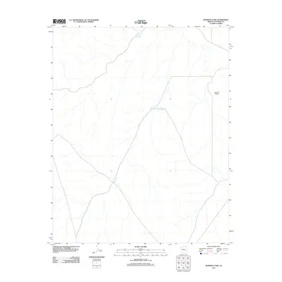
2011 Map of Rosebud Tank
USGS Topo · Published 2011About this map
Coconino Plateau defines the character of this northern Arizona landscape, where water management is the primary marker of human activity across the high country. As of 2011, the terrain is defined by a series of catchment features and isolated tanks, which serve as critical landmarks for local land use and livestock. Names like Broken Axle Tank suggest the practical, often difficult nature of traversing these arid upland stretches. Further south, Rosebud Tank and Blanko Tank sit at the nexus of unimproved roads and drainage ways, illustrating how the scarce water resources dictate the movement and settlement patterns of this section of Coconino County. This topographic study provides a focused look at the environmental infrastructure necessary for life and work on the plateau in the early 21st century.
Find a feature on this map
4 named features on this map. Tap any name to fly to it.
Don’t see what you’re looking for? This feature index may not catch every label — zoom into the map to look around manually.
Map Details
Editions of this 2011 Rosebud Tank Map
This is the sole edition of this map. No revisions or reprints were ever made.
Other maps of this area

1886 · Chino
USGS Topo · 1:250,000

1891 · Chino
USGS Topo · 1:250,000

1948 · Williams
USGS Topo · 1:250,000

1954 · Williams
USGS Topo · 1:250,000

1956 · Williams
USGS Topo · 1:250,000

1960 · Williams
USGS Topo · 1:250,000

1961 · Williams
USGS Topo · 1:250,000
1979 · Box K Ranch
USGS Topo · 1:24,000

1979 · Little Harpo Canyon
USGS Topo · 1:24,000

1980 · Hazen Hole Tank
USGS Topo · 1:24,000