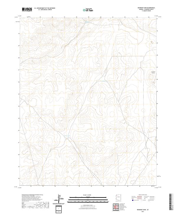
2021 Map of Rosebud Tank
USGS Topo · Published 2021About this map
The Coconino Plateau defines this high-altitude landscape, where the primary topographic interest lies in the essential water catchments that support livestock and wildlife in a dry environment. Named features such as Rosebud Tank, Broken Axle Tank, and Blanko Tank are critical landmarks for understanding the pastoral usage of this region. These tanks, coupled with the intricate network of township and range lines like t28n r3w and t29n r2w, reveal how the land was partitioned for management in northern Arizona. The map illustrates a largely undeveloped terrain where the few named points serve as vital orientation markers for ranchers and land managers navigating the expansive plateau.
Find a feature on this map
10 named features on this map. Tap any name to fly to it.
Don’t see what you’re looking for? This feature index may not catch every label — zoom into the map to look around manually.
Map Details
Editions of this 2021 Rosebud Tank Map
This is the sole edition of this map. No revisions or reprints were ever made.
Other maps of this area

1886 · Chino
USGS Topo · 1:250,000

1891 · Chino
USGS Topo · 1:250,000

1948 · Williams
USGS Topo · 1:250,000

1954 · Williams
USGS Topo · 1:250,000

1956 · Williams
USGS Topo · 1:250,000

1960 · Williams
USGS Topo · 1:250,000

1961 · Williams
USGS Topo · 1:250,000
1979 · Box K Ranch
USGS Topo · 1:24,000

1979 · Little Harpo Canyon
USGS Topo · 1:24,000

1980 · Hazen Hole Tank
USGS Topo · 1:24,000