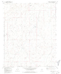
1981 Map of Rosebud Tank
USGS Topo · Published 1981About this map
Rosebud Tank and the surrounding high plateau of Coconino County define this landscape as it appeared in the mid-1970s. The map illustrates a specialized cattle-ranching environment where water management is the primary human imprint on the terrain. These artificial catchments, including the descriptively named Broken Axle Tank and the centrally located Blanko Tank, are the critical landmarks for navigation and survival in this arid region of the Southwest. Beyond these water features and a scattered network of unimproved roads, the sheet reflects an expansive area of open range and subtle topographic shifts, captured through photogrammetric methods by the Geological Survey during a period of precise modern mapping.
Find a feature on this map
5 named features on this map. Tap any name to fly to it.
Don’t see what you’re looking for? This feature index may not catch every label — zoom into the map to look around manually.
Map Details
Editions of this 1981 Rosebud Tank Map
This is the sole edition of this map. No revisions or reprints were ever made.
Other maps of this area

1886 · Chino
USGS Topo · 1:250,000

1891 · Chino
USGS Topo · 1:250,000

1948 · Williams
USGS Topo · 1:250,000

1954 · Williams
USGS Topo · 1:250,000

1956 · Williams
USGS Topo · 1:250,000

1960 · Williams
USGS Topo · 1:250,000

1961 · Williams
USGS Topo · 1:250,000
1979 · Box K Ranch
USGS Topo · 1:24,000

1979 · Little Harpo Canyon
USGS Topo · 1:24,000

1980 · Hazen Hole Tank
USGS Topo · 1:24,000