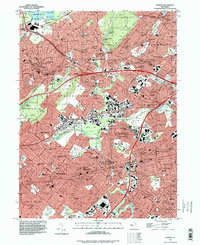
2023 Map of Roselle
USGS Topo · Published 2023About this map
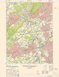
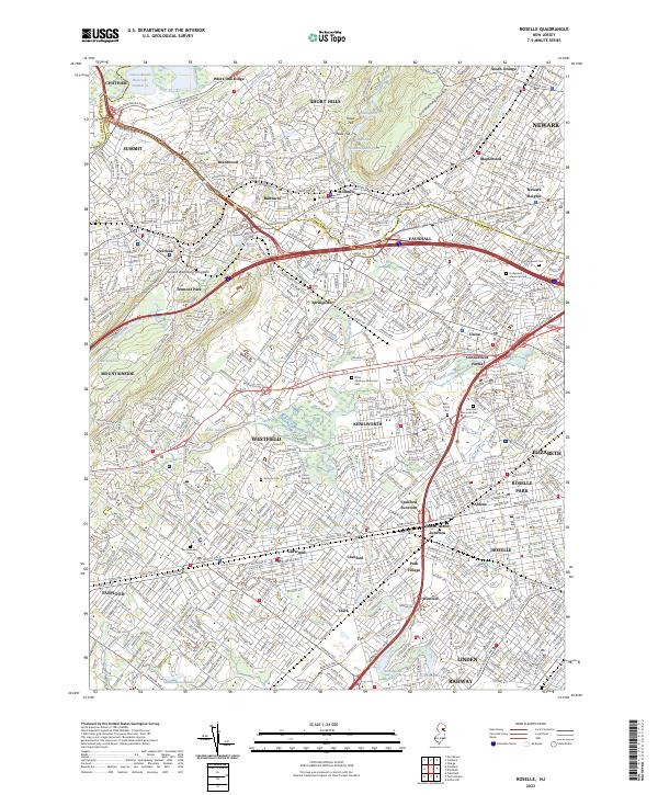
The Rahway River and its various tributaries, including Nomahegan Brook and the West Branch Elizabeth River, define the suburban landscape between Summit and Roselle. This corridor is densely packed with residential growth and established institutions like Union County College. The map reveals a complex history of land use, where major transportation arteries like the Garden State Pkwy and Conrail lines intersect with older landmarks such as the Revolutionary Cem. Significant green spaces and water management systems are visible, from Canoe Brook Reservoir Number 2 in the north to Echo Lake and Lake Surprise in the west. The area's commemorative history is well-represented by several large memorial sites, including Graceland Memorial Park and Hollywood Memorial Park Cem, illustrating the development patterns of Union and surrounding townships.
Find a feature on this map
69 named features on this map. Tap any name to fly to it.
Don’t see what you’re looking for? This feature index may not catch every label — zoom into the map to look around manually.
Map Details
Editions of this 2023 Roselle Map
This is the sole edition of this map. No revisions or reprints were ever made.
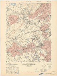
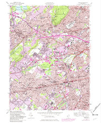
Historical Maps of Clark Through Time
5 maps found