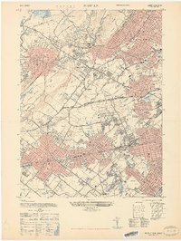
1947 Map of Roselle
USGS Topo · Published 1947About this map
Cranford and its surrounding Union County neighbors sit at a dense intersection of mid-century infrastructure and preserved green space. The landscape is defined by its complex transportation networks, notably the Central RR of New Jersey and the Lehigh Valley RR, which converge near Cranford Junction. These rail corridors served as the backbone for industrial and residential growth in Garwood, Roselle, and Westfield during the post-war era.
Find a feature on this map
63 named features on this map. Tap any name to fly to it.
Don’t see what you’re looking for? This feature index may not catch every label — zoom into the map to look around manually.
Map Details
Editions of this 1947 Roselle Map
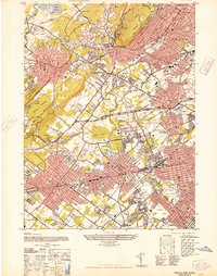
2 editions found
Other maps of this area

1888 · Plainfield
USGS Topo · 1:62,500

1888 · Morristown
USGS Topo · 1:62,500

1888 · Paterson
USGS Topo · 1:62,500

1892 · Paterson
USGS Topo · 1:62,500

1893 · Plainfield
USGS Topo · 1:62,500

1894 · Morristown
USGS Topo · 1:62,500

1898 · Morristown
USGS Topo · 1:62,500

1898 · Plainfield
USGS Topo · 1:62,500

1898 · Staten Island
USGS Topo · 1:62,500

1898 · Paterson
USGS Topo · 1:62,500