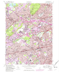
1955 Map of Roselle
USGS Topo · Published 1982About this map
South Mountain Reservation and the Watchung Reservation anchor the wooded highlands of this Union County landscape, while the valleys between them show the dense post-war suburbanization of Northern New Jersey. The residential corridors of Summit, Springfield, and Cranford are shown as they expanded in the mid-1950s, bisected by the evolving routes of U S Highway 22 and the Garden State Parkway.
Find a feature on this map
102 named features on this map. Tap any name to fly to it.
Don’t see what you’re looking for? This feature index may not catch every label — zoom into the map to look around manually.
Map Details
Editions of this 1955 Roselle Map
4 editions found
Other maps of this area

1888 · Plainfield
USGS Topo · 1:62,500

1888 · Morristown
USGS Topo · 1:62,500

1888 · Paterson
USGS Topo · 1:62,500

1892 · Paterson
USGS Topo · 1:62,500

1893 · Plainfield
USGS Topo · 1:62,500

1894 · Morristown
USGS Topo · 1:62,500

1898 · Morristown
USGS Topo · 1:62,500

1898 · Plainfield
USGS Topo · 1:62,500

1898 · Staten Island
USGS Topo · 1:62,500

1898 · Paterson
USGS Topo · 1:62,500