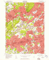
1955 Map of Roselle
USGS Topo · Published 1958About this map
The Passaic River and Rahway River define the industrial and residential corridors of Union and Essex counties during this mid-century period of suburban expansion. Major rail lines, including the Lackawanna RR and Pennsylvania RR, cut through established neighborhoods in Summit, Westfield, and Cranford, while the newly developed Garden State Parkway and New Jersey Turnpike signal the rising dominance of the automobile.
Find a feature on this map
116 named features on this map. Tap any name to fly to it.
Don’t see what you’re looking for? This feature index may not catch every label — zoom into the map to look around manually.
Map Details
Editions of this 1955 Roselle Map
4 editions found
Other maps of this area

1888 · Plainfield
USGS Topo · 1:62,500

1888 · Morristown
USGS Topo · 1:62,500

1888 · Paterson
USGS Topo · 1:62,500

1892 · Paterson
USGS Topo · 1:62,500

1893 · Plainfield
USGS Topo · 1:62,500

1894 · Morristown
USGS Topo · 1:62,500

1898 · Morristown
USGS Topo · 1:62,500

1898 · Plainfield
USGS Topo · 1:62,500

1898 · Staten Island
USGS Topo · 1:62,500

1898 · Paterson
USGS Topo · 1:62,500