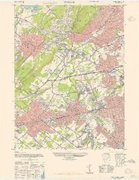
1943 Map of Roselle
USGS Topo · Published 1947About this map
Cranford Junction serves as the industrial and transit heart of this Union County landscape, where the Baltimore & Ohio RR, Reading RR, and Lehigh Valley RR converge. This 1940s survey reveals a densely developed corridor stretching from Westfield and Garwood through to Roselle Park, showing the established street grids that defined these suburban communities during the war years. The landscape is a mix of tight residential blocks and sprawling recreational green spaces like the Baltusrol Golf Course and Galloping Hill Golf Course.
Find a feature on this map
89 named features on this map. Tap any name to fly to it.
Don’t see what you’re looking for? This feature index may not catch every label — zoom into the map to look around manually.
Map Details
Editions of this 1943 Roselle Map
This is the sole edition of this map. No revisions or reprints were ever made.
Other maps of this area

1888 · Plainfield
USGS Topo · 1:62,500

1888 · Morristown
USGS Topo · 1:62,500

1888 · Paterson
USGS Topo · 1:62,500

1892 · Paterson
USGS Topo · 1:62,500

1893 · Plainfield
USGS Topo · 1:62,500

1894 · Morristown
USGS Topo · 1:62,500

1898 · Morristown
USGS Topo · 1:62,500

1898 · Plainfield
USGS Topo · 1:62,500

1898 · Staten Island
USGS Topo · 1:62,500

1898 · Paterson
USGS Topo · 1:62,500