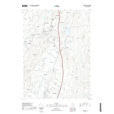
2019 Map of Rosendale
USGS Topo · Published 2019About this map
The Wallkill Valley Rail Trail carves a path through the heart of Ulster County, tracing the historical corridor from the northern outskirts of New Paltz through Rosendale Plains and toward the Rosendale Hamlet. The landscape is defined by the convergence of the Wallkill River and Rondout Creek, which meet near the village of Rosendale. In the west, the steep rise of the Shawangunk Mountains and the prominent Bonticou Crag offer a stark contrast to the water-rich lowlands where the Swarte Kill and Coxing Kill drain. Local history is anchored by several burial grounds, including Saint Peters Cem and Coxing Cem, while the industrial and agricultural past is evidenced by clusters like High Falls, Tillson, and Rifton. Significant local infrastructure is noted by the presence of Stanton Airport and educational centers such as Ulster Boces.
Find a feature on this map
149 named features on this map. Tap any name to fly to it.
Don’t see what you’re looking for? This feature index may not catch every label — zoom into the map to look around manually.
Map Details
Editions of this 2019 Rosendale Map
This is the sole edition of this map. No revisions or reprints were ever made.
Other maps of this area

1893 · Poughkeepsie
USGS Topo · 1:62,500

1894 · Poughkeepsie
USGS Topo · 1:62,500

1898 · Rhinebeck
USGS Topo · 1:62,500

1901 · Rosendale
USGS Topo · 1:62,500

1903 · Poughkeepsie
USGS Topo · 1:62,500

1903 · Newburg
USGS Topo · 1:62,500

1903 · Rosendale
USGS Topo · 1:62,500

1934 · Rhinebeck
USGS Topo · 1:48,000

1936 · Poughkeepsie
USGS Topo · 1:48,000

1939 · Rhinebeck
USGS Topo · 1:62,500