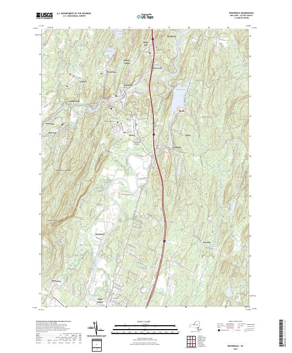
2023 Map of Rosendale
USGS Topo · Published 2023About this map
Rondout Creek and the Wallkill River converge in this modern study of Ulster County, where the landscape is defined by the sharp rise of the Shawangunk Mountains and the Marlboro Mountains. The valley floor is dotted with a dense network of hamlets including Rosendale, Tillson, and High Falls, reflecting a long history of water-powered industry and settlement along the riparian corridors. Higher elevations are marked by the dramatic Bonticou Crag and the waters of Fifth Lake.
Find a feature on this map
153 named features on this map. Tap any name to fly to it.
Don’t see what you’re looking for? This feature index may not catch every label — zoom into the map to look around manually.
Map Details
Editions of this 2023 Rosendale Map
This is the sole edition of this map. No revisions or reprints were ever made.
Other maps of this area

1893 · Poughkeepsie
USGS Topo · 1:62,500

1894 · Poughkeepsie
USGS Topo · 1:62,500

1898 · Rhinebeck
USGS Topo · 1:62,500

1901 · Rosendale
USGS Topo · 1:62,500

1903 · Poughkeepsie
USGS Topo · 1:62,500

1903 · Newburg
USGS Topo · 1:62,500

1903 · Rosendale
USGS Topo · 1:62,500

1934 · Rhinebeck
USGS Topo · 1:48,000

1936 · Poughkeepsie
USGS Topo · 1:48,000

1939 · Rhinebeck
USGS Topo · 1:62,500