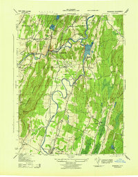
1943 Map of Rosendale
USGS Topo · Published 1943About this map
The Wallkill River and Rondout Creek dominate the landscape of Ulster County in this wartime survey, converging amidst a region shaped by industry and topography. The industrial footprint of the Century Cement Co and the Snyder Lime Plant near Rosendale highlights the area's importance to New York's masonry and building trades. Transportation networks are intricately detailed, including the remnants of the Delaware And Hudson Canal and the tracks of the New York Central and New York Ontario And Western railroads. The western edge is defined by the steep rises of the Shawangunk Mountains, where landmarks like Bonticou Crag and Guyot Hill stand above family farmsteads such as the Mollenhauer Farm. Local life is visible through numerous rural schools, including Rock School and Maple Hill School, alongside the State Police Headquarters at New Paltz.
Find a feature on this map
58 named features on this map. Tap any name to fly to it.
Don’t see what you’re looking for? This feature index may not catch every label — zoom into the map to look around manually.
Map Details
Editions of this 1943 Rosendale Map
This is the sole edition of this map. No revisions or reprints were ever made.
Other maps of this area

1893 · Poughkeepsie
USGS Topo · 1:62,500

1894 · Poughkeepsie
USGS Topo · 1:62,500

1898 · Rhinebeck
USGS Topo · 1:62,500

1901 · Rosendale
USGS Topo · 1:62,500

1903 · Poughkeepsie
USGS Topo · 1:62,500

1903 · Newburg
USGS Topo · 1:62,500

1903 · Rosendale
USGS Topo · 1:62,500

1934 · Rhinebeck
USGS Topo · 1:48,000

1936 · Poughkeepsie
USGS Topo · 1:48,000

1939 · Rhinebeck
USGS Topo · 1:62,500