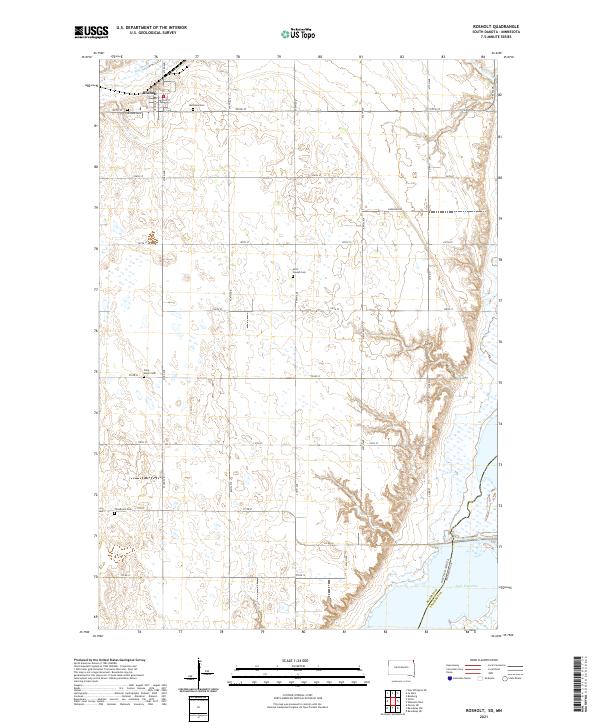
2021 Map of Rosholt
USGS Topo · Published 2021About this map
Rosholt serves as the primary settlement hub for this corner of Roberts County, South Dakota, situated near the northeastern border with Minnesota. The landscape is defined by the expansive waters of Lake Traverse in the southeast and the winding path of Big Slough to the north. A strong sense of local lineage and community history is evident through the numerous rural burial sites scattered across the township lines, including Hillside Cem, Bethania Cem, Saint Peter Cem, and Trondhjem Cem. The survey illustrates a structured grid of section roads like 105th St and 107th St that connect these remote spiritual landmarks and family farms. The proximity to the state line is marked by the South Dakota Minnesota boundary, highlighting the region's position as a gateway between the two states.
Find a feature on this map
31 named features on this map. Tap any name to fly to it.
Don’t see what you’re looking for? This feature index may not catch every label — zoom into the map to look around manually.
Map Details
Editions of this 2021 Rosholt Map
This is the sole edition of this map. No revisions or reprints were ever made.
Other maps of this area

1915 · White Rock
USGS Topo · 1:62,500

1916 · Peever
USGS Topo · 1:62,500

1916 · Beardsley
USGS Topo · 1:62,500

1917 · New Effington
USGS Topo · 1:62,500

1918 · Peever
USGS Topo · 1:62,500

1918 · White Rock
USGS Topo · 1:62,500

1918 · Beardsley
USGS Topo · 1:62,500

1953 · Milbank
USGS Topo · 1:250,000

1958 · Milbank
USGS Topo · 1:250,000
1971 · Peever NE
USGS Topo · 1:24,000