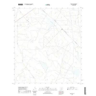
2019 Map of Rosita NW
USGS Topo · Published 2019About this map
San Cajo and the brush country of northwestern Duval County are defined by an intricate network of intermittent drainage and private ranch roads. This 2019 survey captures the modern landscape of the Texas Coastal Bend, where the meandering path of San Diego Creek (also labeled San Diego Cr) carves through low-lying terrain. The area is largely dedicated to large-scale ranching and private landholdings, evidenced by landmarks like the Triple B Ranch Airport. Transportation is dictated by a mix of established routes like FM 2359 and historically descriptive paths such as Old Seven Sisters Rd. In the northern portion of the map, Chiltipin Cr crosses the landscape near the junction of Camino Piedras Rd, illustrating the characteristic topography of South Texas where water access remains a primary geographic driver.
Find a feature on this map
12 named features on this map. Tap any name to fly to it.
Don’t see what you’re looking for? This feature index may not catch every label — zoom into the map to look around manually.
Map Details
Editions of this 2019 Rosita NW Map
This is the sole edition of this map. No revisions or reprints were ever made.
Other maps of this area

1920 · Mikeska
USGS Topo · 1:125,000

1937 · Loma Alta
USGS Topo · 1:62,500

1953 · Crystal City
USGS Topo · 1:250,000

1955 · Crystal City
USGS Topo · 1:250,000

1956 · Rosita Ranch
USGS Topo · 1:62,500

1956 · Freer
USGS Topo · 1:62,500

1956 · Laredo
USGS Topo · 1:250,000

1961 · Crystal City
USGS Topo · 1:250,000

1968 · Crystal City
USGS Topo · 1:250,000
1968 · Rosita
USGS Topo · 1:24,000