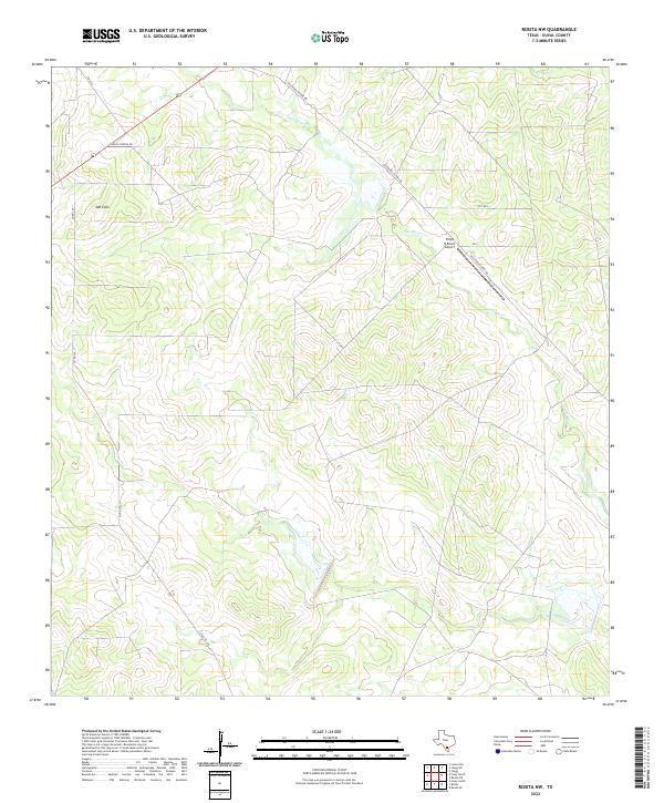
2022 Map of Rosita NW
USGS Topo · Published 2022About this map
San Cajo marks a pocket of development in this rural stretch of Duval County, where the landscape is defined by intermittent drainage and ranching infrastructure. The topographic data reveals a network of roads and tracks, including Old Seven Sisters RD and Camino Piedras RD, that navigate the undulating terrain typical of this part of South Texas. Watercourses like San Diego Cr and Chiltipin Cr cut through the brush country, though their seasonal nature is evident. A notable landmark in the eastern portion of the sheet is the Triple B Ranch Airport, indicating the importance of private aviation for transportation in these larger ranching tracts. Researchers can trace the division of land through the presence of various private and county roads, such as Co Rd 407 and Co Rd 330, which provide access to interior parcels.
Find a feature on this map
11 named features on this map. Tap any name to fly to it.
Don’t see what you’re looking for? This feature index may not catch every label — zoom into the map to look around manually.
Map Details
Editions of this 2022 Rosita NW Map
This is the sole edition of this map. No revisions or reprints were ever made.
Other maps of this area

1920 · Mikeska
USGS Topo · 1:125,000

1937 · Loma Alta
USGS Topo · 1:62,500

1953 · Crystal City
USGS Topo · 1:250,000

1955 · Crystal City
USGS Topo · 1:250,000

1956 · Rosita Ranch
USGS Topo · 1:62,500

1956 · Freer
USGS Topo · 1:62,500

1956 · Laredo
USGS Topo · 1:250,000

1961 · Crystal City
USGS Topo · 1:250,000

1968 · Crystal City
USGS Topo · 1:250,000
1968 · Rosita
USGS Topo · 1:24,000