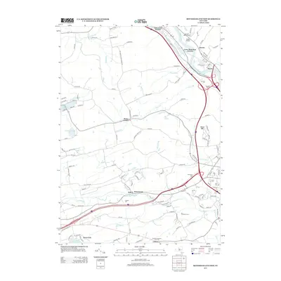
2013 Map of Rotterdam Junction
USGS Topo · Published 2013About this map
Rotterdam Junction serves as the focal point for this landscape along the Mohawk River, where modern transportation corridors follow the natural path carved by old waterways. The terrain rises from the river valley toward West Hill, bisected by numerous kills and brooks including Plotter Kill, Sandsea Kill, and Poentic Kill. Local heritage is preserved in a high density of burial grounds, ranging from the Princetown Reformed Church Cem near Gifford to the Van Slyck Cem and Ferguson Cem. Small settlements like Rynex Corners, Rectors, and Wyatts are interconnected by a network of rural roads such as Reynolds Rd and Scotch Ridge Rd. This 2013 survey illustrates the continued importance of regional infrastructure, featuring the Mohawk Valley Airport and the expansive Briar Creek Golf Course, while documenting recreational waters at Duane Lake and Maria Lake.
Find a feature on this map
122 named features on this map. Tap any name to fly to it.
Don’t see what you’re looking for? This feature index may not catch every label — zoom into the map to look around manually.
Map Details
Editions of this 2013 Rotterdam Junction Map
This is the sole edition of this map. No revisions or reprints were ever made.
Other maps of this area

1893 · Schenectady
USGS Topo · 1:62,500

1893 · Albany
USGS Topo · 1:62,500

1895 · Albany
USGS Topo · 1:62,500

1895 · Schenectady
USGS Topo · 1:62,500

1895 · Amsterdam
USGS Topo · 1:62,500

1898 · Schenectady
USGS Topo · 1:62,500

1898 · Albany
USGS Topo · 1:62,500

1900 · Berne
USGS Topo · 1:62,500

1903 · Berne
USGS Topo · 1:62,500

1927 · Albany
USGS Topo · 1:62,500