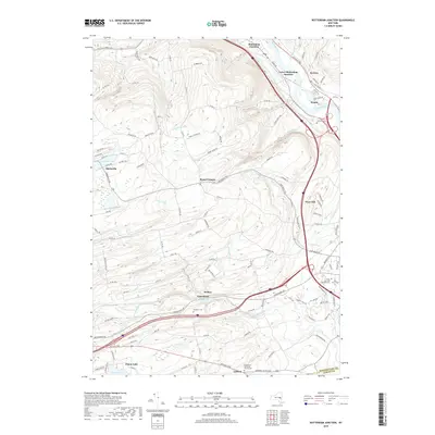
2019 Map of Rotterdam Junction
USGS Topo · Published 2019About this map
Rotterdam Junction and Lower Rotterdam Junction occupy a narrow shelf between the hills and the Mohawk River in this 2019 survey of the Schenectady and Albany county borderlands. The landscape transitions from the river valley to the elevated terrain of West Hill, where numerous waterways like the Sandsea Kill, Moccasin Kill, and Plotter Kill carve distinct paths toward the Mohawk. These drainages define the settlement patterns of the interior, where crossroads like Rynex Corners and the community of Princetown developed along historic turnpikes.
Find a feature on this map
126 named features on this map. Tap any name to fly to it.
Don’t see what you’re looking for? This feature index may not catch every label — zoom into the map to look around manually.
Map Details
Editions of this 2019 Rotterdam Junction Map
This is the sole edition of this map. No revisions or reprints were ever made.
Other maps of this area

1893 · Schenectady
USGS Topo · 1:62,500

1893 · Albany
USGS Topo · 1:62,500

1895 · Albany
USGS Topo · 1:62,500

1895 · Schenectady
USGS Topo · 1:62,500

1895 · Amsterdam
USGS Topo · 1:62,500

1898 · Schenectady
USGS Topo · 1:62,500

1898 · Albany
USGS Topo · 1:62,500

1900 · Berne
USGS Topo · 1:62,500

1903 · Berne
USGS Topo · 1:62,500

1927 · Albany
USGS Topo · 1:62,500