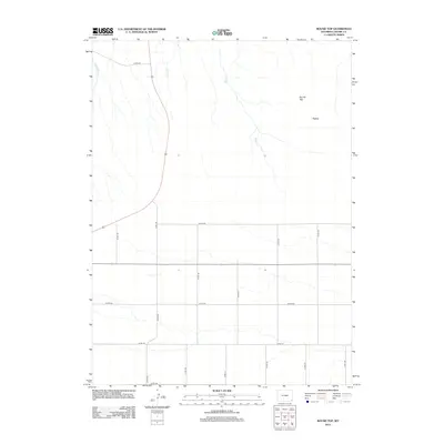
2012 Map of Round Top
USGS Topo · Published 2012About this map
Round Top and the adjacent Flattop mesa rise above the high plains of Laramie County in this modern topographic survey. The landscape is defined by a rhythmic grid of rural roads, including Co RD-234, Co RD-230, and Co RD-228, which trace the section lines of the Public Land Survey System. These corridors facilitate movement across a largely open range drained by several seasonal watercourses. The drainage patterns of Bull Spring Cr, Herrick Cr, and Mills Cr flow generally southward, carving subtle relief into the plateau. This map illustrates the intersection of modern county infrastructure with the enduring topography of the Wyoming plains, where the vastness of the terrain is organized by a geometric network of transport and land division.
Find a feature on this map
17 named features on this map. Tap any name to fly to it.
Don’t see what you’re looking for? This feature index may not catch every label — zoom into the map to look around manually.
Map Details
Editions of this 2012 Round Top Map
This is the sole edition of this map. No revisions or reprints were ever made.
Other maps of this area

1899 · Goshen Hole
USGS Topo · 1:125,000

1954 · Cheyenne
USGS Topo · 1:250,000

1958 · Cheyenne
USGS Topo · 1:250,000

1960 · Petsch Reservoir
USGS Topo · 1:24,000

1960 · Rocky Hollow
USGS Topo · 1:24,000

1960 · Meriden
USGS Topo · 1:24,000

1963 · Midway
USGS Topo · 1:24,000

1963 · Midway SE
USGS Topo · 1:24,000
1963 · Round Top
USGS Topo · 1:24,000

1963 · Midway SW
USGS Topo · 1:24,000