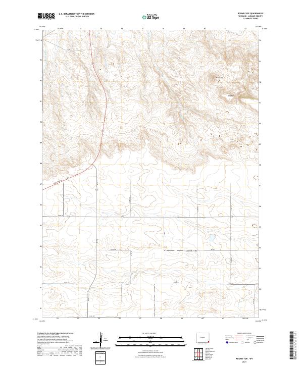
2021 Map of Round Top
USGS Topo · Published 2021About this map
The high plateau country of Laramie County is dominated by the prominent elevations of Round Top and Flattop, which anchor the high ground in the northeastern section of this survey. The landscape is defined by the headwaters of several ephemeral drainages, including Bull Spring Cr and Herrick Cr, which flow through the section lines of the Public Land Survey System. Modern connectivity is facilitated by a network of county roads such as Albin Rd and Torrington Rd, illustrating the grid-based development typical of the Wyoming plains. The survey also traces the path of Mills Cr through the northern townships, providing a clear view of the water sources that have influenced land use and ranching boundaries in this region of the High Plains.
Find a feature on this map
26 named features on this map. Tap any name to fly to it.
Don’t see what you’re looking for? This feature index may not catch every label — zoom into the map to look around manually.
Map Details
Editions of this 2021 Round Top Map
This is the sole edition of this map. No revisions or reprints were ever made.
Other maps of this area

1899 · Goshen Hole
USGS Topo · 1:125,000

1954 · Cheyenne
USGS Topo · 1:250,000

1958 · Cheyenne
USGS Topo · 1:250,000

1960 · Petsch Reservoir
USGS Topo · 1:24,000

1960 · Rocky Hollow
USGS Topo · 1:24,000

1960 · Meriden
USGS Topo · 1:24,000

1963 · Midway
USGS Topo · 1:24,000

1963 · Midway SE
USGS Topo · 1:24,000
1963 · Round Top
USGS Topo · 1:24,000

1963 · Midway SW
USGS Topo · 1:24,000