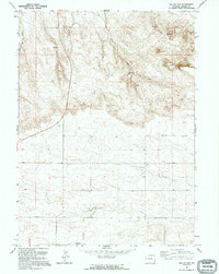
1991 Map of Round Top
USGS Topo · Published 1995About this map
Round Top and Hunter Flattop dominate this Laramie County landscape, where the high plains meet distinctive geological formations. The terrain is defined by a series of drainages, including Bull Spring Creek, Herrick Creek, and Mills Creek, which carve through the elevated plateaus. Though largely open range, the presence of the Golden Prairie Alliance Ch. in the southern portion of the quadrangle suggests a focal point for the local rural community. This 1991 survey, compiled from imagery dating back to 1958, shows a region primarily shaped by natural topography and isolated human activity, such as a Gravel Pit and scattered Well sites, reflecting the persistent ranching and land-use patterns of the Wyoming prairie.
Find a feature on this map
9 named features on this map. Tap any name to fly to it.
Don’t see what you’re looking for? This feature index may not catch every label — zoom into the map to look around manually.
Map Details
Editions of this 1991 Round Top Map
This is the sole edition of this map. No revisions or reprints were ever made.
Other maps of this area

1899 · Goshen Hole
USGS Topo · 1:125,000

1954 · Cheyenne
USGS Topo · 1:250,000

1958 · Cheyenne
USGS Topo · 1:250,000

1960 · Petsch Reservoir
USGS Topo · 1:24,000

1960 · Rocky Hollow
USGS Topo · 1:24,000

1960 · Meriden
USGS Topo · 1:24,000

1963 · Midway
USGS Topo · 1:24,000

1963 · Midway SE
USGS Topo · 1:24,000
1963 · Round Top
USGS Topo · 1:24,000

1963 · Midway SW
USGS Topo · 1:24,000