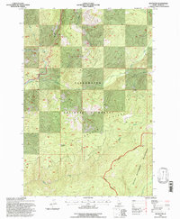
1994 Map of Roundtop
USGS Topo · Published 1997About this map
The Lewis and Clark National Historic Trail follows a high, winding route through this mountain landscape, mirroring the historic passage of explorers across the Beaver Ridge divide. This 1994 revision shows the area as a preserved wilderness and forest interior, where human presence is largely limited to backcountry stations like the Roundtop Lookout and primitive stopping points such as Glade Creek Camp and 21 Mile Camp.
Find a feature on this map
20 named features on this map. Tap any name to fly to it.
Don’t see what you’re looking for? This feature index may not catch every label — zoom into the map to look around manually.
Map Details
Editions of this 1994 Roundtop Map
This is the sole edition of this map. No revisions or reprints were ever made.
Other maps of this area

1901 · Hamilton
USGS Topo · 1:125,000

1911 · Lolo
USGS Topo · 1:250,000

1912 · Missoula
USGS Topo · 1:125,000

1913 · Lolo
USGS Topo · 1:250,000

1956 · Hamilton
USGS Topo · 1:250,000

1959 · Hamilton
USGS Topo · 1:250,000

1960 · Hamilton
USGS Topo · 1:250,000

1964 · Hamilton
USGS Topo · 1:250,000

1964 · Lolo Hot Springs
USGS Topo · 1:24,000

1964 · West Fork Butte
USGS Topo · 1:24,000