
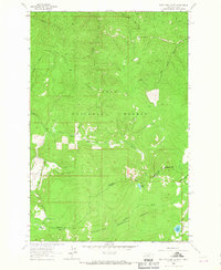
1964 Map of West Fork Butte
USGS Topo · Published 1967About this map
The Montana-Idaho state line divides this high-elevation wilderness where the Lolo National Forest meets the Clearwater National Forest. Strategic high ground is marked by fire towers, including Lookout 6137 atop West Fork Butte and Lookout 7215 further south, overlooking a landscape defined by sharp ridges and deep drainages. The northern portion is characterized by Sally Ridge and the Sally Basin, while the south contains more alpine features like the Lost Park Meadows and the waters of Granite Lake. Historically, travel through this difficult terrain relied on a network of primitive routes, shown here as a Jeep Trail and Pack Trail systems. These paths connect the headwaters of East Fork Lolo Creek and Brushy Fork, tracing the same topographic corridors used for decades by forest rangers and early surveyors.
Find a feature on this map
26 named features on this map. Tap any name to fly to it.
Don’t see what you’re looking for? This feature index may not catch every label — zoom into the map to look around manually.
Map Details
Editions of this 1964 West Fork Butte Map
2 editions found
Other maps of this area

1911 · Lolo
USGS Topo · 1:250,000

1912 · Missoula
USGS Topo · 1:125,000

1913 · Lolo
USGS Topo · 1:250,000

1956 · Hamilton
USGS Topo · 1:250,000

1959 · Hamilton
USGS Topo · 1:250,000

1960 · Hamilton
USGS Topo · 1:250,000

1964 · Hamilton
USGS Topo · 1:250,000

1964 · Lolo Hot Springs
USGS Topo · 1:24,000

1964 · Garden Point
USGS Topo · 1:24,000

1964 · Dick Creek
USGS Topo · 1:24,000