2023 Map of Rouses Point
USGS Topo · Published 2023About this map
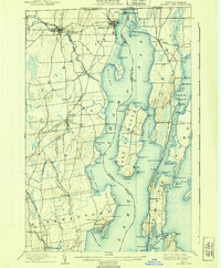
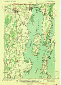
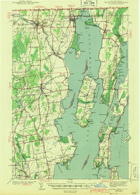
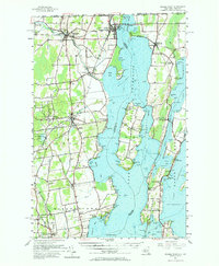
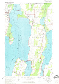
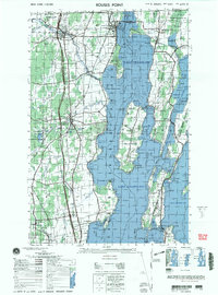
The complex shoreline of northern Lake Champlain dominates this borderlands geography, where the state lines of New York and Vermont meet. On the western shore, the village of Rouses Point serves as a critical transit hub, historically linked to the Vermont side by the Alburg Rouses Point Ferry. Across the water, the Alburg Tongue extends southward, a peninsula defined by a dense network of family and community landmarks. Genealogists will find several burial sites including Bush Cem, Alburg Center Cem, and the Reynolds McGregor Cem near Mud Point. Further south, the island of Isle la Motte features the Saint Anne's Shrine Columbarium and Saint Joseph Cem near Blanchard Bay. The aquatic landscape is equally detailed, noting navigation hazards like Windmill Point Reef and Point au Fer Reef, alongside numerous small islands such as Pine Island and Hemlock Island.
Find a feature on this map
101 named features on this map. Tap any name to fly to it.
Don’t see what you’re looking for? This feature index may not catch every label — zoom into the map to look around manually.
Map Details
Editions of this 2023 Rouses Point Map
This is the sole edition of this map. No revisions or reprints were ever made.
Historical Maps of Alburgh Through Time
7 maps found