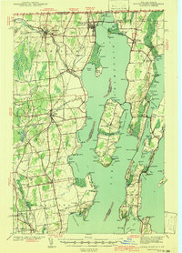
1939 Map of Rouses Point
USGS Topo · Published 1941About this map
The border crossing at Rouses Point and the strategic waters of Lake Champlain define this 1939 survey, where the international boundary meets the state line between New York and Vermont. At the northernmost edge, Fort Montgomery and a Custom House stand guard over the Richelieu River, while the Rutland and Delaware and Hudson railroads converge to manage the flow of traffic between the two nations. The landscape is a network of peninsulas and islands, notably Isle La Motte and the peninsula of Point au Fer, which were critical navigation points in the early Republic.
Find a feature on this map
127 named features on this map. Tap any name to fly to it.
Don’t see what you’re looking for? This feature index may not catch every label — zoom into the map to look around manually.
Map Details
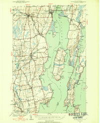
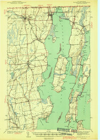
Editions of this 1939 Rouses Point Map
4 editions found

Other maps of this area

1894 · Plattsburg
USGS Topo · 1:62,500

1895 · Mooers
USGS Topo · 1:62,500

1895 · Rouse Point
USGS Topo · 1:62,500

1899 · Mooers
USGS Topo · 1:62,500

1906 · Plattsburg
USGS Topo · 1:62,500

1907 · Rouse Point
USGS Topo · 1:62,500

1913 · Dannemora
USGS Topo · 1:62,500

1913 · Milton
USGS Topo · 1:48,000

1914 · St. Albans
USGS Topo · 1:48,000

1915 · Milton
USGS Topo · 1:62,500