
1939 Map of Rouses Point
USGS Topo · Published 1939About this map
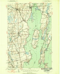
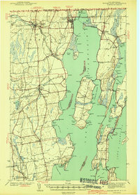
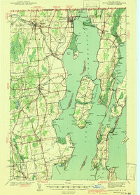
Fort Montgomery stands as a sentinel at the northern edge of Lake Champlain, guarding the border crossing between the Canada United States boundary. This 1939 survey illustrates a landscape defined by the convergence of major transportation lines and waterborne trade, where the Rutland and Delaware and Hudson railroads meet at the international gateway of Rouses Point. The map captures the rural density of Clinton County, New York, and the neighboring Vermont islands, featuring numerous one-room schoolhouses like Stratton Hill Sch and Ladue Sch. To the west, the Great Chazy River winds past Champlain and Chazy, while the expansive Isle La Motte shows the footprint of local industry with a dedicated Quarry. From the U.S. Custom House to the quiet cemeteries like Doane Cem, the map documents a vital transit corridor at the end of the pre-war era.
Find a feature on this map
134 named features on this map. Tap any name to fly to it.
Don’t see what you’re looking for? This feature index may not catch every label — zoom into the map to look around manually.
Map Details
Editions of this 1939 Rouses Point Map
4 editions found
Other maps of this area

1894 · Plattsburg
USGS Topo · 1:62,500

1895 · Mooers
USGS Topo · 1:62,500

1895 · Rouse Point
USGS Topo · 1:62,500

1899 · Mooers
USGS Topo · 1:62,500

1906 · Plattsburg
USGS Topo · 1:62,500

1907 · Rouse Point
USGS Topo · 1:62,500

1913 · Dannemora
USGS Topo · 1:62,500

1913 · Milton
USGS Topo · 1:48,000

1914 · St. Albans
USGS Topo · 1:48,000

1915 · Milton
USGS Topo · 1:62,500