
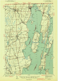
1943 Map of Rouses Point
USGS Topo · Published 1943About this map
The Canada United States border and the meeting of New York, Quebec, and Vermont define this northern frontier landscape at the head of Lake Champlain. Fort Montgomery and a Custom House stand watch over the Richelieu River as it flows north from the lake, marking a site of critical international transit. The rail infrastructure of the Rutland and Delaware and Hudson lines ties together settlements like Rouses Point and Alburg, facilitating the movement of goods across the islands and waterways.
Find a feature on this map
175 named features on this map. Tap any name to fly to it.
Don’t see what you’re looking for? This feature index may not catch every label — zoom into the map to look around manually.
Map Details
Editions of this 1943 Rouses Point Map
2 editions found
Other maps of this area

1894 · Plattsburg
USGS Topo · 1:62,500

1895 · Mooers
USGS Topo · 1:62,500

1895 · Rouse Point
USGS Topo · 1:62,500

1899 · Mooers
USGS Topo · 1:62,500

1906 · Plattsburg
USGS Topo · 1:62,500

1907 · Rouse Point
USGS Topo · 1:62,500

1913 · Dannemora
USGS Topo · 1:62,500

1913 · Milton
USGS Topo · 1:48,000

1914 · St. Albans
USGS Topo · 1:48,000

1915 · Milton
USGS Topo · 1:62,500