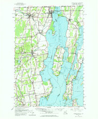
1956 Map of Rouses Point
USGS Topo · Published 1965About this map
The northern tip of Lake Champlain serves as the focal point for this borderlands survey, where the Richelieu River flows north toward the Quebec line. The maritime character of the region is evident in the numerous lights and points, such as Windmill Pt Light and Point au Fer, which guided traffic through the Point au Fer Channel. On the New York shore, the village of Rouses Point stands as a primary port of entry with its US Customs house and the nearby Fort Montgomery (Ruins) guarding the narrows.
Find a feature on this map
169 named features on this map. Tap any name to fly to it.
Don’t see what you’re looking for? This feature index may not catch every label — zoom into the map to look around manually.
Map Details
Editions of this 1956 Rouses Point Map
2 editions found

Other maps of this area

1894 · Plattsburg
USGS Topo · 1:62,500

1895 · Mooers
USGS Topo · 1:62,500

1895 · Rouse Point
USGS Topo · 1:62,500

1899 · Mooers
USGS Topo · 1:62,500

1906 · Plattsburg
USGS Topo · 1:62,500

1907 · Rouse Point
USGS Topo · 1:62,500

1913 · Dannemora
USGS Topo · 1:62,500

1913 · Milton
USGS Topo · 1:48,000

1914 · St. Albans
USGS Topo · 1:48,000

1915 · Milton
USGS Topo · 1:62,500