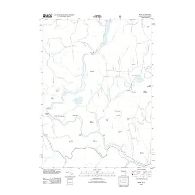
2012 Map of Rowe
USGS Topo · Published 2012About this map
The Deerfield River carves a deep valley through this northern Massachusetts landscape, defining the industrial and transportation corridor between Monroe Bridge and Zoar. The map captures a high-energy hydraulic landscape, featuring the Sherman Reservoir and the Bear Swamp Upper Reservoir, which reflect the region's long-standing reliance on water for power. This era of mapping shows the enduring footprint of the nineteenth-century rail engineering feat, the Hoosac Tunnel, which enters the earth near Hoosac Tunnel Station along the river's edge.
Find a feature on this map
127 named features on this map. Tap any name to fly to it.
Don’t see what you’re looking for? This feature index may not catch every label — zoom into the map to look around manually.
Map Details
Editions of this 2012 Rowe Map
This is the sole edition of this map. No revisions or reprints were ever made.
Other maps of this area

1886 · Greylock
USGS Topo · 1:62,500

1886 · Hawley
USGS Topo · 1:62,500

1889 · Wilmington
USGS Topo · 1:62,500

1890 · Hawley
USGS Topo · 1:62,500

1891 · Wilmington
USGS Topo · 1:62,500

1891 · Greylock
USGS Topo · 1:62,500

1893 · Greylock
USGS Topo · 1:62,500

1894 · Hawley
USGS Topo · 1:62,500

1898 · Bennington
USGS Topo · 1:62,500

1898 · Greylock
USGS Topo · 1:62,500