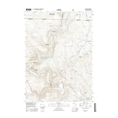
2015 Map of Rowe
USGS Topo · Published 2015About this map
The Hoosac Tunnel defines the industrial and transportation geography of this region, cutting through the high ridges of the Berkshires near Hoosac Tunnel Station. This 2015 survey shows the modern configuration of the Deerfield River and its hydroelectric infrastructure, including the Sherman Reservoir, Bear Swamp Upper Reservoir, and Lower Reservoir-Bear Swamp. The settlements of Rowe, Monroe Bridge, and Zoar are spaced along the river and its winding valley roads, connected by historic crossings such as the Florida Bridge. Genealogists and local historians can locate several family-named landmarks and burial grounds, such as the Nelson Family Cem, Hawks Cem, and the West Cem. The landscape transitions northward from the river banks of Charlemont toward the Green Mountain National Forest at the Vermont border.
Find a feature on this map
109 named features on this map. Tap any name to fly to it.
Don’t see what you’re looking for? This feature index may not catch every label — zoom into the map to look around manually.
Map Details
Editions of this 2015 Rowe Map
This is the sole edition of this map. No revisions or reprints were ever made.
Other maps of this area

1886 · Greylock
USGS Topo · 1:62,500

1886 · Hawley
USGS Topo · 1:62,500

1889 · Wilmington
USGS Topo · 1:62,500

1890 · Hawley
USGS Topo · 1:62,500

1891 · Wilmington
USGS Topo · 1:62,500

1891 · Greylock
USGS Topo · 1:62,500

1893 · Greylock
USGS Topo · 1:62,500

1894 · Hawley
USGS Topo · 1:62,500

1898 · Bennington
USGS Topo · 1:62,500

1898 · Greylock
USGS Topo · 1:62,500