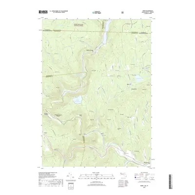
2018 Map of Rowe
USGS Topo · Published 2018About this map
The Deerfield River carves a deep path through this borderland where Massachusetts meets Vermont, defining a landscape of steep ridges and industrial history. The presence of the Hoosac Tunnel and its nearby Hoosac Tunnel Station marks a significant feat of nineteenth-century engineering that remains central to the region's character. To the north, Monroe Bridge sits along the river's edge, while the town of Rowe is situated near Pelham Lake and Camp Rowe. The terrain is punctuated by high points like Todd Mtn and Adams Mtn, with the Green Mountain National Forest extending across the northern boundary. Genealogists will find several resting places scattered across the hills, including the Nelson Family Cem near Florida Bridge and the Hawks Cem further south near Charlemont. The hydrography is equally complex, featuring the Upper Reservoir Bear Swamp and numerous mountain streams like Pelham Brook.
Find a feature on this map
124 named features on this map. Tap any name to fly to it.
Don’t see what you’re looking for? This feature index may not catch every label — zoom into the map to look around manually.
Map Details
Editions of this 2018 Rowe Map
This is the sole edition of this map. No revisions or reprints were ever made.
Other maps of this area

1886 · Greylock
USGS Topo · 1:62,500

1886 · Hawley
USGS Topo · 1:62,500

1889 · Wilmington
USGS Topo · 1:62,500

1890 · Hawley
USGS Topo · 1:62,500

1891 · Wilmington
USGS Topo · 1:62,500

1891 · Greylock
USGS Topo · 1:62,500

1893 · Greylock
USGS Topo · 1:62,500

1894 · Hawley
USGS Topo · 1:62,500

1898 · Bennington
USGS Topo · 1:62,500

1898 · Greylock
USGS Topo · 1:62,500