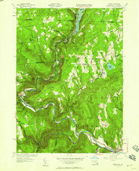
1944 Map of Rowe
USGS Topo · Published 1958About this map
The Deerfield River carves a deep valley through the Berkshire highlands, defining the industrial and transit corridor of this mid-century landscape. This survey documents a critical junction of engineering and infrastructure, anchored by the Hoosac Tunnel and the Boston and Maine Railroad which shadow the river's winding course. The village of Monroe Bridge sits at a narrow point in the canyon, while the settlement of Rowe occupies the higher plateau to the east, near Pelham Lake.
Find a feature on this map
55 named features on this map. Tap any name to fly to it.
Don’t see what you’re looking for? This feature index may not catch every label — zoom into the map to look around manually.
Map Details
Editions of this 1944 Rowe Map
This is the sole edition of this map. No revisions or reprints were ever made.
Other maps of this area

1886 · Greylock
USGS Topo · 1:62,500

1886 · Hawley
USGS Topo · 1:62,500

1889 · Wilmington
USGS Topo · 1:62,500

1890 · Hawley
USGS Topo · 1:62,500

1891 · Wilmington
USGS Topo · 1:62,500

1891 · Greylock
USGS Topo · 1:62,500

1893 · Greylock
USGS Topo · 1:62,500

1894 · Hawley
USGS Topo · 1:62,500

1898 · Bennington
USGS Topo · 1:62,500

1898 · Greylock
USGS Topo · 1:62,500