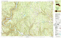
1990 Map of Rowe
USGS Topo · Published 1990About this map
The Deerfield River carves a deep path through the northwestern corner of Massachusetts in this 1990 survey, marking a landscape defined by significant hydroelectric and industrial infrastructure. The presence of the Nuclear Powerplant and an Underground Powerplant near the Upper Reservoir Bear Swamp illustrates the region's late 20th-century role in power generation. High-elevation water management is evident at Sherman Reservoir on the Vermont border and the Lower Reservoir downstream.
Find a feature on this map
88 named features on this map. Tap any name to fly to it.
Don’t see what you’re looking for? This feature index may not catch every label — zoom into the map to look around manually.
Map Details
Editions of this 1990 Rowe Map
2 editions found
Other maps of this area

1886 · Greylock
USGS Topo · 1:62,500

1886 · Hawley
USGS Topo · 1:62,500

1889 · Wilmington
USGS Topo · 1:62,500

1890 · Hawley
USGS Topo · 1:62,500

1890 · Greenfield
USGS Topo · 1:62,500

1891 · Wilmington
USGS Topo · 1:62,500

1891 · Greylock
USGS Topo · 1:62,500

1891 · Brattleboro
USGS Topo · 1:62,500

1893 · Brattleboro
USGS Topo · 1:62,500

1893 · Greylock
USGS Topo · 1:62,500