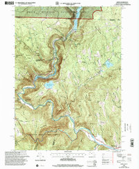
1997 Map of Rowe
USGS Topo · Published 2000About this map
Negus Mountain and the deep gorge of the Deerfield River define this corner of Franklin County, where the infrastructure of the late 20th century meets rugged New England terrain. The map documents the complex water management systems of the area, featuring the Sherman Reservoir, Upper Reservoir Bear Swamp, and Lower Reservoir, which support a regional Powerplant and Substation. This industrial presence is balanced by the extensive tracts of the Monroe State Forest and Mohawk Trail State Forest, preserving the wild character of the Hoosac Range.
Find a feature on this map
76 named features on this map. Tap any name to fly to it.
Don’t see what you’re looking for? This feature index may not catch every label — zoom into the map to look around manually.
Map Details
Editions of this 1997 Rowe Map
This is the sole edition of this map. No revisions or reprints were ever made.
Other maps of this area

1886 · Greylock
USGS Topo · 1:62,500

1886 · Hawley
USGS Topo · 1:62,500

1889 · Wilmington
USGS Topo · 1:62,500

1890 · Hawley
USGS Topo · 1:62,500

1891 · Wilmington
USGS Topo · 1:62,500

1891 · Greylock
USGS Topo · 1:62,500

1893 · Greylock
USGS Topo · 1:62,500

1894 · Hawley
USGS Topo · 1:62,500

1898 · Bennington
USGS Topo · 1:62,500

1898 · Greylock
USGS Topo · 1:62,500