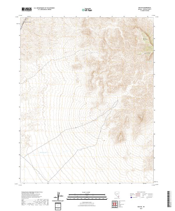
2021 Map of Rox NE
USGS Topo · Published 2021About this map
Mormon Mountains dominate the landscape of this corner of Lincoln County, where the high desert terrain rises sharply toward Mormon Peak. This 2021 survey illustrates a sparse but significant network of water and travel routes essential for navigating the high-elevation slopes. Drainages like Mormon Canyon in the northwest and Whitmore Wash in the south carve through the township lines of t11s r66e and t12s r66e. A critical water source for local geography and ranching history, Davies Spring, is located on the eastern slopes, while CO Rte 4210 provides one of the few named access points into this remote portion of the Great Basin. The map's layout of section lines and township markers provides a clear framework for researchers studying public land surveys and land ownership in rural Nevada.
Find a feature on this map
10 named features on this map. Tap any name to fly to it.
Don’t see what you’re looking for? This feature index may not catch every label — zoom into the map to look around manually.
Map Details
Editions of this 2021 Rox NE Map
This is the sole edition of this map. No revisions or reprints were ever made.
Other maps of this area

1885 · Pioche
USGS Topo · 1:250,000

1886 · Saint Thomas
USGS Topo · 1:250,000

1886 · Pioche
USGS Topo · 1:250,000

1893 · Saint Thomas
USGS Topo · 1:250,000

1954 · Caliente
USGS Topo · 1:250,000

1954 · Las Vegas
USGS Topo · 1:250,000

1957 · Las Vegas
USGS Topo · 1:250,000

1959 · Caliente
USGS Topo · 1:250,000

1959 · Las Vegas
USGS Topo · 1:250,000

1962 · Las Vegas
USGS Topo · 1:250,000