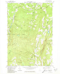
1980 Map of Roxbury
USGS Topo · Published 1981About this map
The Dog River valley serves as the central corridor for this 1980s landscape, where the Central Vermont railroad tracks parallel the water through the village of Roxbury. This Vermont interior is characterized by high, named elevations like Shaw Mtn and Drinkwater Hill, interspersed with isolated institutional landmarks such as the Rabbit Hollow Sch and the State Fish Hatchery. The map highlights a community deeply connected to its terrain, featuring recreational sites like Teela-Wooket Camp and Camp Wihakowi alongside working landscapes of gravel pits and quarries.
Find a feature on this map
59 named features on this map. Tap any name to fly to it.
Don’t see what you’re looking for? This feature index may not catch every label — zoom into the map to look around manually.
Map Details
Editions of this 1980 Roxbury Map
2 editions found
Other maps of this area

1915 · Rochester
USGS Topo · 1:62,500

1917 · Rochester
USGS Topo · 1:62,500

1919 · Royalton
USGS Topo · 1:62,500

1919 · Lincoln Mountain
USGS Topo · 1:62,500

1920 · Lincoln Mountain
USGS Topo · 1:48,000

1921 · Lincoln Mountain
USGS Topo · 1:62,500

1922 · Barre
USGS Topo · 1:48,000

1924 · Barre
USGS Topo · 1:62,500

1924 · Randolph
USGS Topo · 1:48,000

1926 · Randolph
USGS Topo · 1:62,500