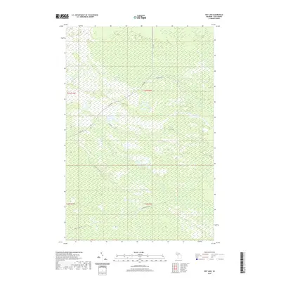
2019 Map of Roy Lake
USGS Topo · Published 2019About this map
Roy Lake serves as a central landmark in this 2019 survey of the Luce County backwoods. The terrain is defined by a dense network of wetlands and small water bodies, including Quintus Lake, Lynch Lake, and Coyote Lake. Drainage is provided by a series of small streams such as Murphy Cr, Gimlet Cr, and Auger Cr, which wind through the township boundaries of T47N and T46N.
Find a feature on this map
17 named features on this map. Tap any name to fly to it.
Don’t see what you’re looking for? This feature index may not catch every label — zoom into the map to look around manually.
Map Details
Editions of this 2019 Roy Lake Map
This is the sole edition of this map. No revisions or reprints were ever made.
Other maps of this area

1954 · Sault Sainte Marie
USGS Topo · 1:250,000

1956 · Sault Sainte Marie
USGS Topo · 1:250,000

1957 · Sault Sainte Marie
USGS Topo · 1:250,000

1958 · Sault Sainte Marie
USGS Topo · 1:250,000

1962 · Auger Lake
USGS Topo · 1:24,000

1968 · Muskallonge Lake SE
USGS Topo · 1:24,000

1968 · Betsy Lake SW
USGS Topo · 1:24,000
1968 · Betsy Lake South
USGS Topo · 1:24,000
1973 · Newberry
USGS Topo · 1:24,000
1973 · Roberts Corner
USGS Topo · 1:24,000